Eastern Indonesia: Land of Fire and Spice
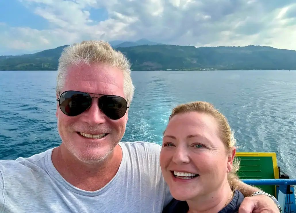 Spencer Wells/SeaTrek Sailing Adventures
By Dr. Spencer Wells
Indonesia is a surprisingly massive country, its true scale obscured by the Mercator Projection. Stretching more than 5,000 km from northern Sumatra to the middle of New Guinea, it spans a distance comparable to Ireland and Kazakhstan. It’s more than 17,000 islands encompass an extraordinary range of landscapes, from tropical rainforests and savannas to glaciated alpine peaks.
Imagine flying eastward across the archipelago. We first encounter the so-called Greater Sunda islands. Sumatra and Borneo contain some of the world’s oldest rainforests and are among the only places where tigers, rhinos, elephants and great apes coexist. Yet their geological histories are very different. Volcanic Sumatra and Java lie on the Pacific “Ring of Fire” and have experienced devastating earthquakes and tsunamis, while Borneo has no active volcanoes and little seismic activity.
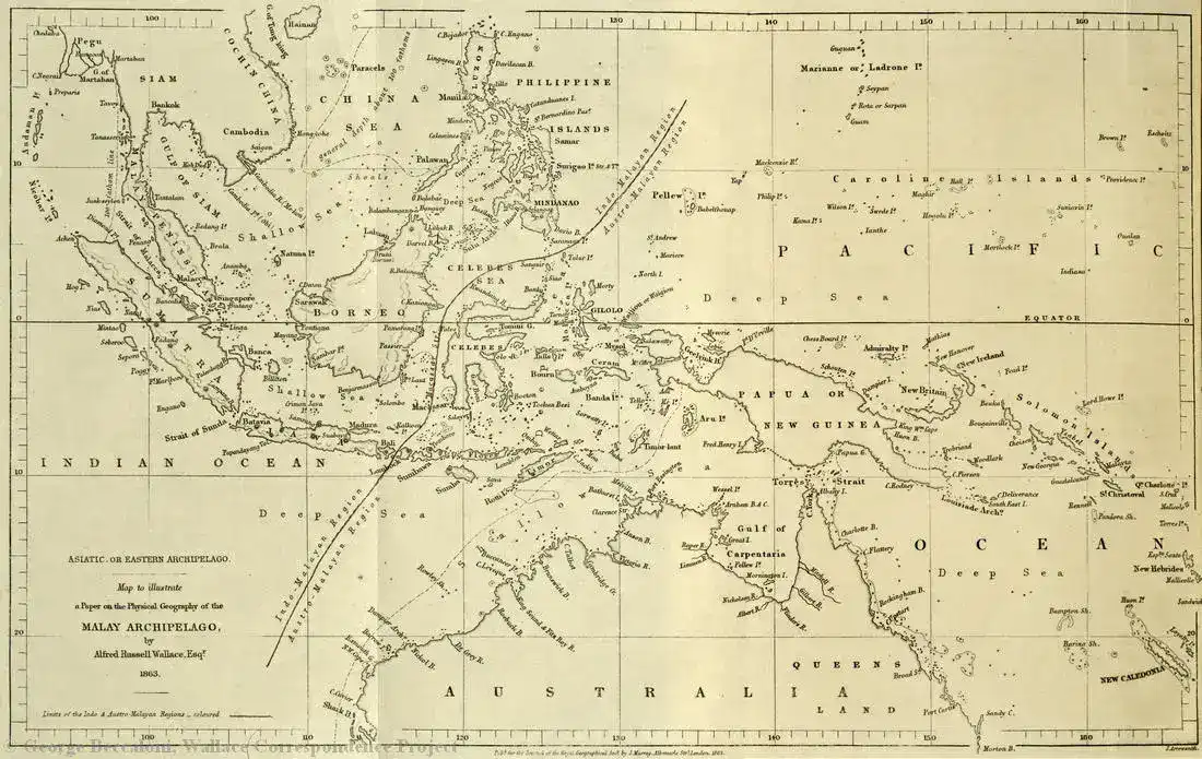
The Wallace Line (in dark red). (George Beccaloni/SeaTrek Sailing Adventures)
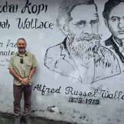
East of Java, however, the biological character of Indonesia changes dramatically. Between Bali and Lombok lies the famous Wallace Line, identified by British naturalist Alfred Russel Wallace in the 19th century. It marks a fundamental divide between Asian and Australasian wildlife. To the west are animals such as tigers and elephants; to the east are species more closely related to those of Australia.
Our Seatrek journey takes us through eastern Indonesia, from Flores through the so-called “forgotten islands” of Southern Maluku, stopping at Alor – with its great tradition of ikat weaving – and the Banda Islands, tracing Indonesia’s geological, biological, and human history.
Plates and Ice
Indonesia sits at one of Earth’s great geological hotspots. The Australian tectonic plate is moving northeastward at roughly 7 cm per year, subducting beneath the Sunda plate to the north. This produces the extraordinary chain of volcanoes extending from Sumatra through Java, Bali and the islands of eastern Indonesia.
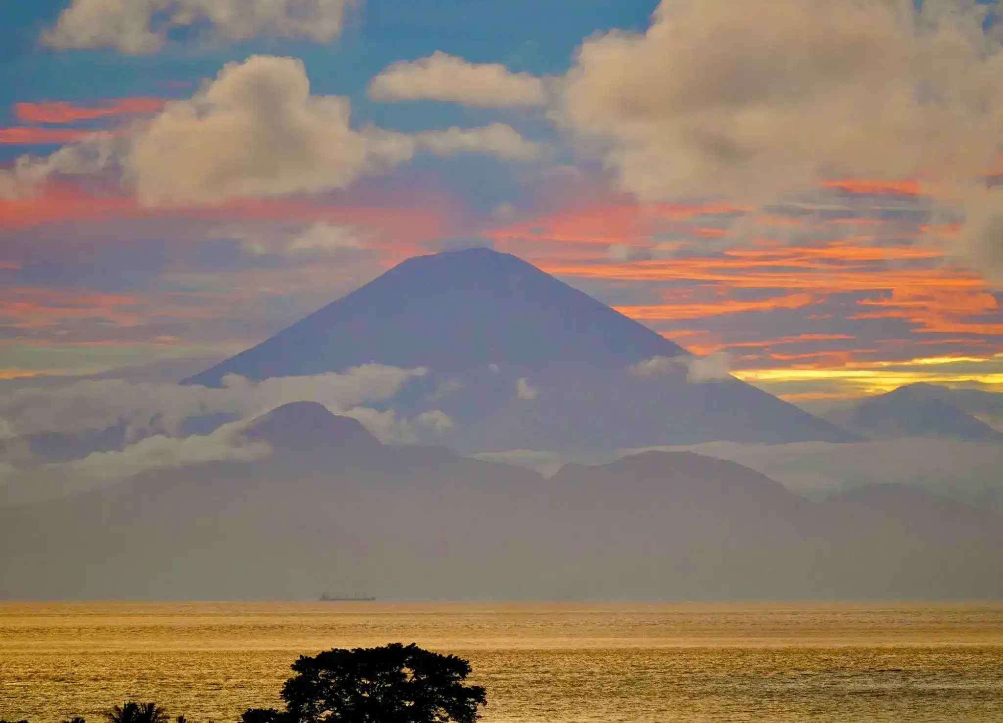
A view from our villa across the Lombok Strait looking toward Gunung Agung in Bali. (Spencer Wells/SeaTrek Sailing Adventures)
This subduction helps explain Indonesia’s biological divisions. The Java Sea over the western Sunda Plate is only about 50 meters deep, while the Flores Sea to the east averages roughly 1,500 meters. During Ice Ages, global sea levels fell by as much as 150 meters, exposing the shallow seabed and joining Sumatra, Borneo, and Java to one another and to mainland Southeast Asia. Animals living there could therefore migrate freely. These land bridges disappeared only about 15,000 years ago.
Farther east, the seas are much deeper. The strait between Bali and Lombok, for example, never became dry land during the Ice Ages. Beyond it lies Wallacea, a world of volcanic islands surrounded by deep ocean. The region’s extreme isolation produced an extraordinary evolutionary laboratory, rich with endemic species. Indonesia’s deepest waters, including the more than 7,000-meter-deep Weber Deep, are found here.
Dragons, Giants and Hobbits
Perhaps Indonesia’s most iconic animal is the Komodo dragon, found today only on the islands of Komodo and Rinca. Nearby Flores has an even stranger history. Until roughly 50,000 years ago, it was home to Homo floresiensis, the diminutive “Hobbit” that stood only about a meter tall, as well as giant rats, dwarf elephants called Stegodon, and enormous storks.
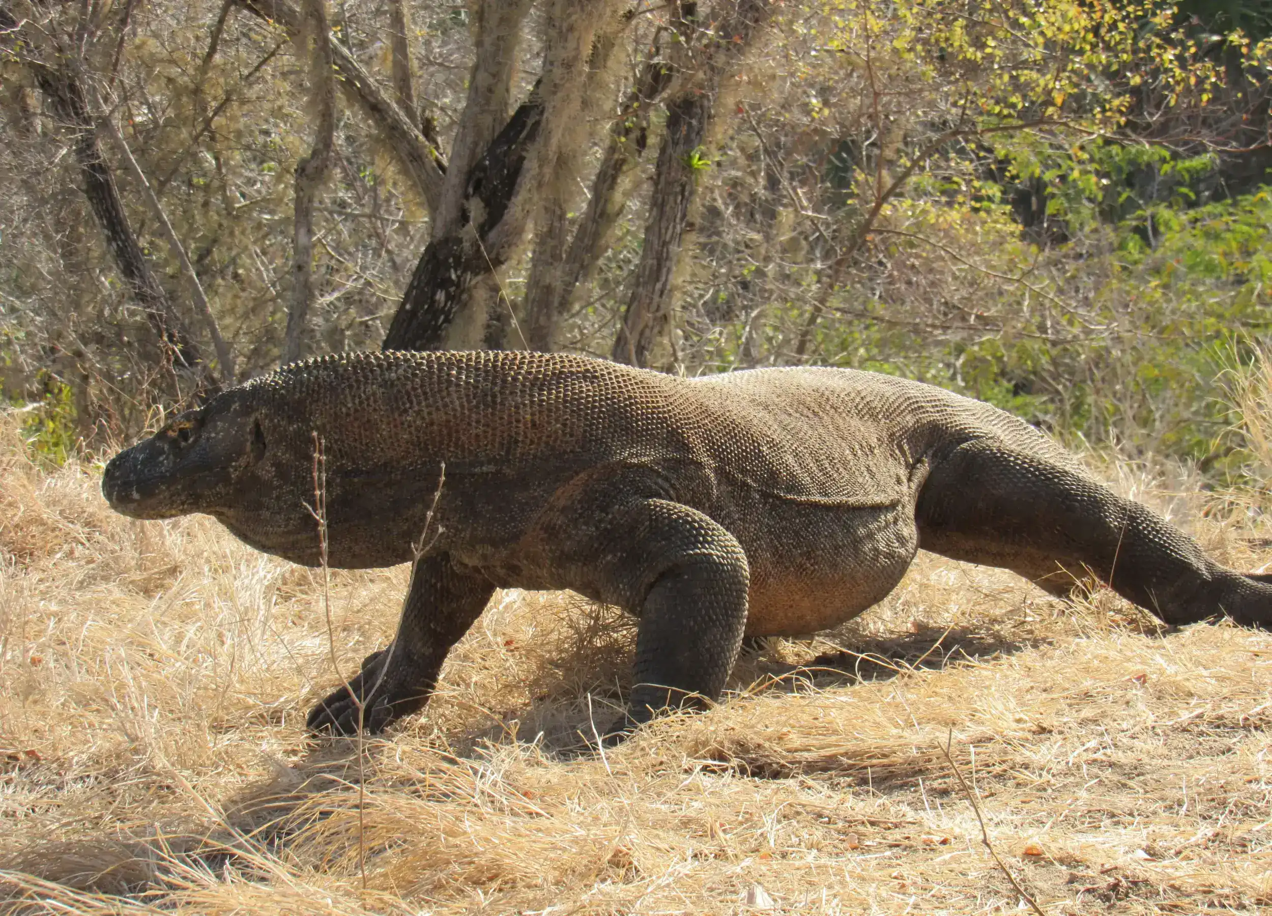
A Giant Komodo Dragon. (Tim Jolly/SeaTrek Sailing Adventures)
The presence of ancient hominins on Flores raises a remarkable question: how did they cross the deep seas separating Wallacea from the western islands? Modern humans faced the same challenge. Ancestors of Aboriginal Australians reached Sahul—the Ice Age landmass joining Australia and New Guinea—perhaps 60,000 years ago, meaning they too had to cross the remote islands of the eastern Indonesian archipelago.
Most Indonesians today descend from a later migration of Austronesian peoples from Taiwan through the Philippines, beginning around 5,000 years ago. Their remarkable seafaring traditions spread across Indonesia and onward to Polynesia and Madagascar. Other communities in eastern Indonesia retain deeper connections to the earlier populations of New Guinea.
The Importance of Spice
Plants, too, followed distinctive evolutionary paths in Wallacea. Two of the world’s most valuable spices originated here: cloves, historically native to the North Maluku islands of Ternate and Tidore, and nutmeg, native to the tiny Banda Islands.

Iconic Spices of the Spice Islands Indonesia. (Joshua Edwards/SeaTrek Sailing Adventures)
These spices became extraordinarily valuable commodities, traveling across the “Silk Road of the Sea” toward India, the Middle East, and Europe. Their scarcity and distant origins made control of the spice trade a major source of wealth and power.
By the 16th century, European powers were determined to reach these spices directly. The Portuguese captured Melaka in 1511 and soon ventured into the eastern archipelago. In 1512, Portuguese forces reached the Banda Islands, the ultimate source of Europe’s nutmeg.
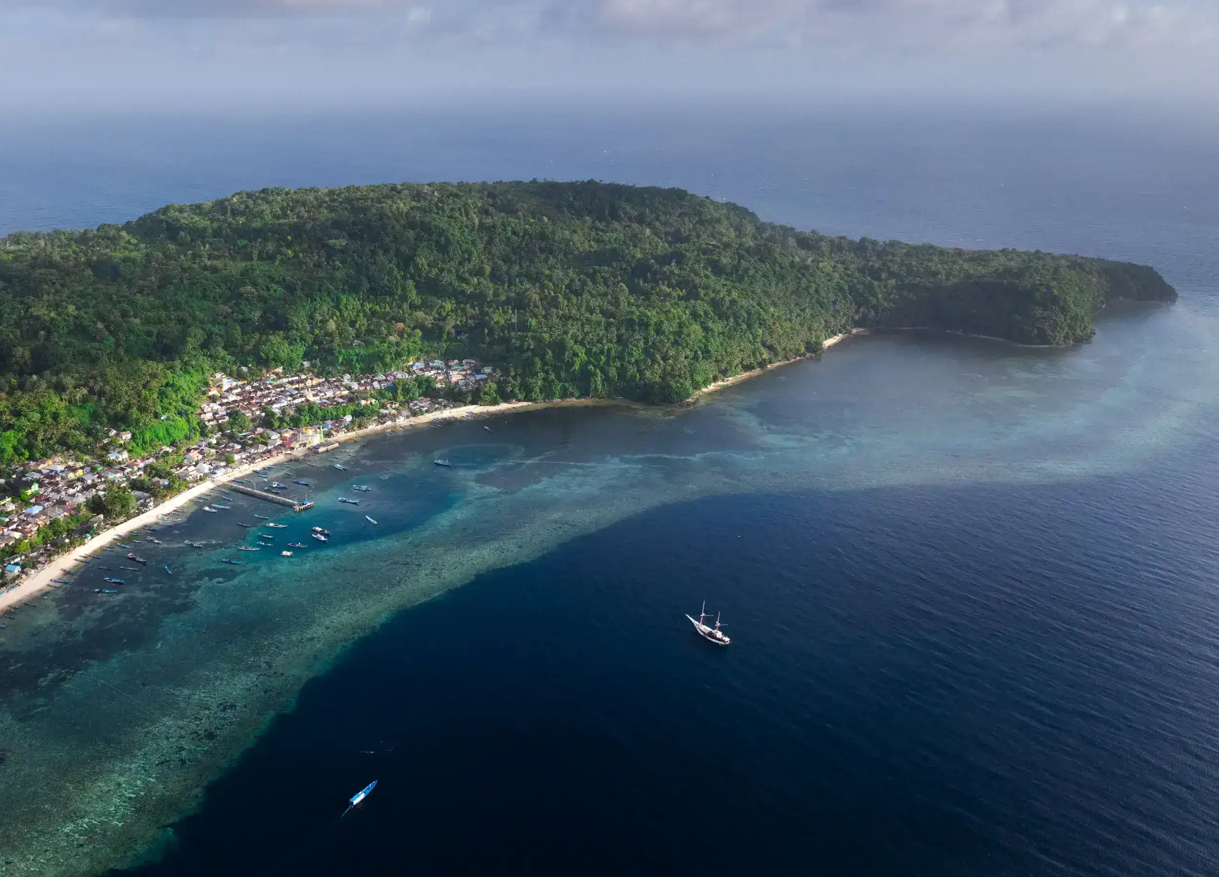
Rhun Island, Banda. (Joshua Edwards/SeaTrek Sailing Adventures)
The Portuguese were eventually displaced by the Dutch and British. In the 1667 Treaty of Breda, the Dutch gained the tiny Banda island of Run while Britain received Manhattan in exchange—a remarkable illustration of just how valuable Indonesia’s spices had become.
Our journey ends in Ambon, whose own complicated history includes a brief declaration of independence in 1950. By then, we will have crossed an archipelago whose geology, biodiversity, human migrations, and spice trade together tell the story of how one of the world’s most extraordinary countries came to be.
 (Dion Luas/SeaTrek Sailing Adventures)
 (SeaTrek Sailing Adventures)
 (George Beccaloni/SeaTrek Sailing Adventures)
 (Carole Clarke/SeaTrek Sailing Adventures)
 (Tinae Siringo-Ringo/SeaTrek Sailing Adventures)
 (Vincent Chalias/SeaTrek Sailing Adventures)
 (SeaTrek Sailing Adventures)
 (SeaTrek Sailing Adventures)
 Hizkia Hukom/SeaTrek Sailing Adventures
 Murray Spence/SeaTrek Sailing Adventures